Infrastructural Nature
Shifting Regimes of Valuing Delta Wetlands - An Anthropocene Parable of Loss and Protection
The term “green infrastructures” denotes an approach to water management that is not only geared towards regionalized risk mitigation, but also encompasses environmental restoration. But what is deemed as “acceptable loss” and what is regarded as a “natural asset”? In other words, how is valuation assigned to nature?
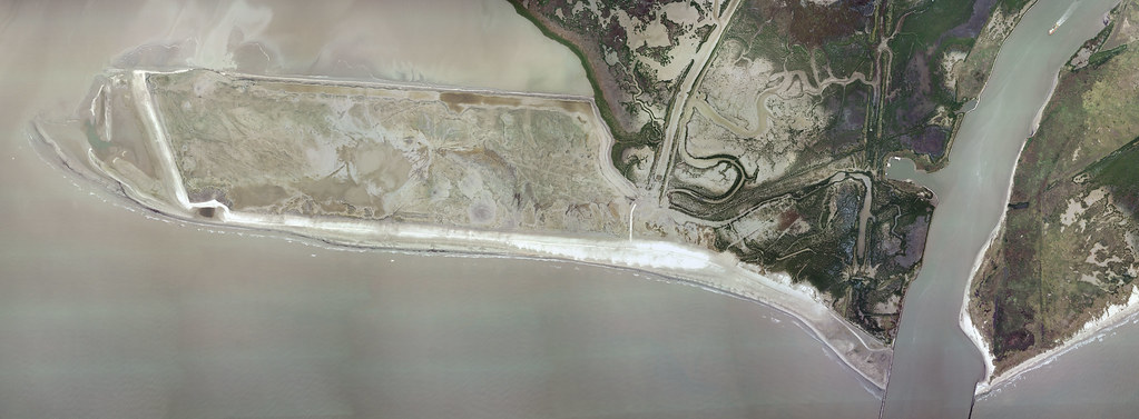
Working critically with the notion of ecosystem services, this project examines how planning around “green infrastructure” is being mobilized in the Delta region of the Mississippi River as a means of reducing risks associated with the changing climate. Framed as both “restoration of nature” and “risk mitigation,” green infrastructure activities have gained prominence and financing ever since Hurricane Katrina hit the coast of Louisiana. Following the 2005 hurricane season, the newly established Coastal Protection and Restoration Authority (CPRA) authored a Coastal Master Plan1 with the aim of directing investments toward reducing storm-surge flood risk for coastal communities and protecting an array of commercial and recreational activities. Currently in the third cycle of its “Plan,” this project leverages the State’s 2023 Plan drafting process to understand how planners are tabulating the benefits of risk reduction within specific parts of the Delta and how nature is being employed to protect against the future impacts of natural phenomena. How, in other words, do we make sense of “green infrastructure” as an increasing response to risk in the Anthropocene?
The Plan’s frame of reference for managing vulnerability is the region: In lieu of discrete, project-sized interventions, regionalized risk reduction focuses on both landscape-scale restoration and a series of small but interlinked interventions. Yet, with limited resources, priorities for protection nonetheless are aimed at specific assets and activities within the state, which the rhetoric around the regional integrity of restoration efforts partly occludes. What is seen as worthy of protection and what is sacrificed? And how is the reconstruction of natural assets conceived and financed toward meeting these goals of “acceptable loss”? One of the principal “tools” identified by the Plan is using natural wetlands and other landscapes as defenses against flooding from storms. This attention to soil replenishment reverses decades of commercial activity directed at extracting and undermining these “natural assets.”
Deploying methods of participant observation and interviews, this research will involve visiting two to three of these sites of natural infrastructure with project developers to understand how the valuations assigned through planning documents are converted into material nature, i.e. barrier islands, ridge and marsh restoration, oyster reefs, etc. In addition to thinking about what determines “acceptable loss,” the project will also focus on mapping specific green-infrastructure professions and practices: What forms of expertise is the state mobilizing to make this redemption of nature a reality; and how does the engineered imaginary of nature influence calculations of benefit and value? And how, finally, do these interventions articulate or participate in notions of equitable risk—the equal sharing out of vulnerability across populations and territories? These largely public investments (local, state, and federal funds; implementation of the 2017 Plan is estimated at 50 billion dollars) also interact with other mechanisms of risk management, such as insurance, and the tools that help determine insurability, such as catastrophe models. A special focus will fall on the linking of public investments in vulnerability-reduction with circuits of private-risk mitigation capital.